Under Contract
Click to read more...
Property Overview
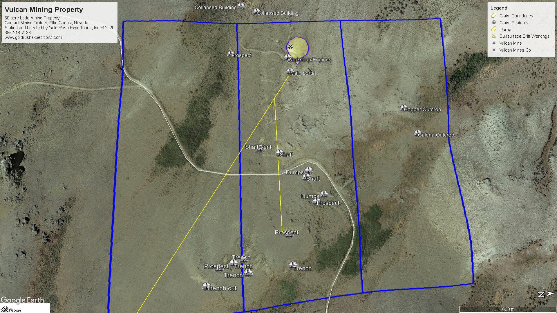
The Vulcan mine is a 60 acre lode gold and silver mining property located just outside of the Jarbidge region, in Northeast Nevada. The lower portal sits at an elevation of 7000’ and the upper shaft is at 7300’. This is extremely high country for Nevada and snow is common October-March.
This property should be viewed as a gold/silver mine with potential for expansion. The mine is noted to have produced gold from steeply dipped quartz veins. These veins run generally East-West and there are noted veins that run north-south which have only had cursory exploration where they were exposed in the workings.
Assay reports taken from the discarded dump material consistently returned 0.3 oz/T in gold and 0.2 in silver. This is an indication that some level of crush and separation was happening as the ore was being brought out. It is likely that high grade ore was crushed, separated by hand and the remaining lower grade material discarded.
This assertion is furthered by the presence of two large engines at the portal of the mine in a workshop of sorts. Likely one engine was powering water and air and the other was powering some sort of crush mechanism. The material on the waste dump is generally fine with most material six inches or less.
It is the opinion, that the mine, similar to many others in the west, was used as a “piggy bank” for the owner/operators. That being the term for mines that contain high grade material but have never been commercially developed. It is not uncommon for small miners and families to work these mines for a few months each year, turn a healthy profit, but never push for full scale development. This is likely the case here as the drifts are in excellent condition and have been well maintained as can be seen.
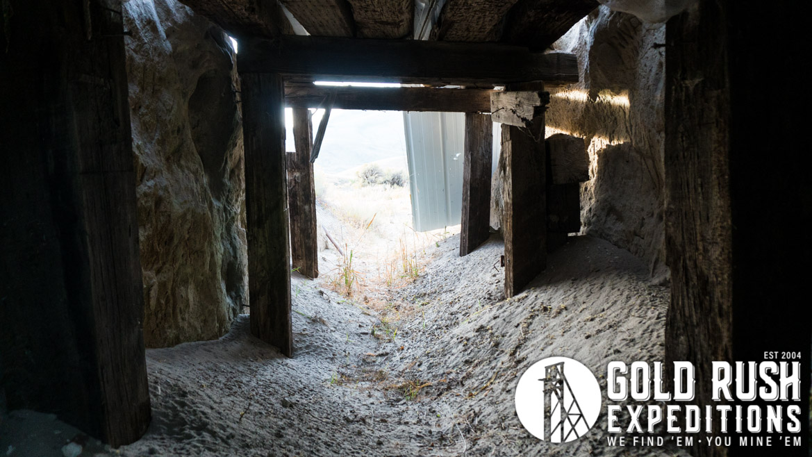
The adit is gated which restricts any public access and there are no records of permits for mining development on the property since 1991.
The mine has been worked intermittently on a small scale since 1912. The main return has been in gold with high silver values. With that in mind, the gold is much easier to crush and pan out, so the majority of the silver has been discarded. The dumps are an estimated 90,000 tons and contain iron, quartz and pyrites. There is a section of the dumps that is separated that shows lead/silver material.
The subsurface workings are largely unknown except of historical accounts and an accounting from a local cattle rancher who has worked the area for the last 40 years. In oral and written reports an adit runs 60 degrees SSE for a reported 1500’. A crosscut at 700’ runs nearly direct east for several hundred feet. A raise is cut about 100’ short of the face and used to reach the surface. There are reportedly two drift levels in the raise. Sometime in the early 1990s, the collar and headframe remnants collapsed, and the shaft is plugged with debris and dirt at the top.
There are two good reports of quartz veins in the mine containing free gold and some silver. Pyrite is common throughout the workings. Based on the dump piles, there is at least one section of sulfide material with the pyrite, it is not a significant portion of the dump but worth noting.
Access to the property is on county roads with no private restriction. 4WD is recommended for navigation of some slopes and a single water crossing.
Gold Rush Expeditions, Inc. does offer mining consultation services and assistance with permits for a small fee.
Training courses for underground work and exploration can be found here: https://stayoutstayalive.com/training/
The Vulcan mine is a 60 acre lode gold and silver mining property located just outside of the Jarbidge region, in Northeast Nevada. The lower portal sits at an elevation of 7000’ and the upper shaft is at 7300’. This is extremely high country for Nevada and snow is common October-March.
This property should be viewed as a gold/silver mine with potential for expansion. The mine is noted to have produced gold from steeply dipped quartz veins. These veins run generally East-West and there are noted veins that run north-south which have only had cursory exploration where they were exposed in the workings.
Assay reports taken from the discarded dump material consistently returned 0.3 oz/T in gold and 0.2 in silver. This is an indication that some level of crush and separation was happening as the ore was being brought out. It is likely that high grade ore was crushed, separated by hand and the remaining lower grade material discarded.
This assertion is furthered by the presence of two large engines at the portal of the mine in a workshop of sorts. Likely one engine was powering water and air and the other was powering some sort of crush mechanism. The material on the waste dump is generally fine with most material six inches or less.
It is the opinion, that the mine, similar to many others in the west, was used as a “piggy bank” for the owner/operators. That being the term for mines that contain high grade material but have never been commercially developed. It is not uncommon for small miners and families to work these mines for a few months each year, turn a healthy profit, but never push for full scale development. This is likely the case here as the drifts are in excellent condition and have been well maintained as can be seen.
The adit is gated which restricts any public access and there are no records of permits for mining development on the property since 1991.
The mine has been worked intermittently on a small scale since 1912. The main return has been in gold with high silver values. With that in mind, the gold is much easier to crush and pan out, so the majority of the silver has been discarded. The dumps are an estimated 90,000 tons and contain iron, quartz and pyrites. There is a section of the dumps that is separated that shows lead/silver material.
The subsurface workings are largely unknown except of historical accounts and an accounting from a local cattle rancher who has worked the area for the last 40 years. In oral and written reports an adit runs 60 degrees SSE for a reported 1500’. A crosscut at 700’ runs nearly direct east for several hundred feet. A raise is cut about 100’ short of the face and used to reach the surface. There are reportedly two drift levels in the raise. Sometime in the early 1990s, the collar and headframe remnants collapsed, and the shaft is plugged with debris and dirt at the top.
There are two good reports of quartz veins in the mine containing free gold and some silver. Pyrite is common throughout the workings. Based on the dump piles, there is at least one section of sulfide material with the pyrite, it is not a significant portion of the dump but worth noting.
Access to the property is on county roads with no private restriction. 4WD is recommended for navigation of some slopes and a single water crossing.
Gold Rush Expeditions, Inc. does offer mining consultation services and assistance with permits for a small fee.
Training courses for underground work and exploration can be found here: https://stayoutstayalive.com.training/
Acres
Commodities
Type
60
Gold, Silver, Copper, Zinc
Lode
Underground Dev
Surface Dump
Tailings
N/A
90,234 tons
N/A
Access
Features
High Clearance 4WD
N/A
Gold Reserves
Silver Reserves
Copper Reserves
Platinum Reserves
Tungsten Reserves
Molybdenum Reserves
28,432 oz
21,565 oz
Undefined
N/A
N/A
N/A
(385) 218-2138
or use our contact form below