

Click to read more...
Property Overview
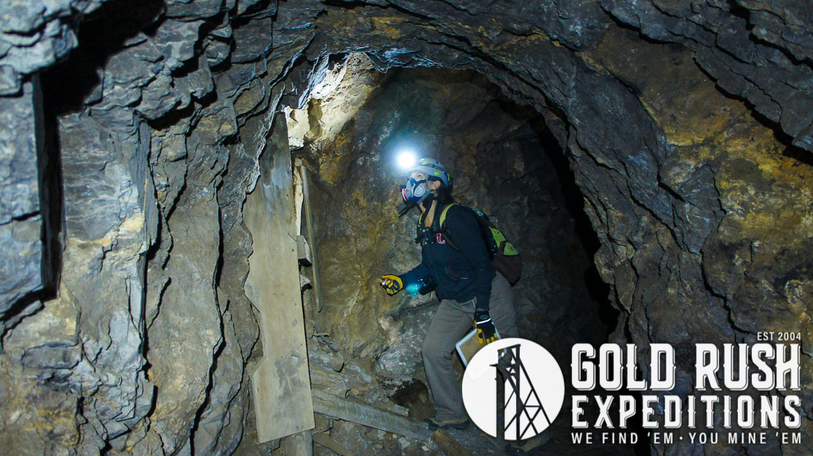
The Parker site is a 40 acre lode mining property located in the Radersburg Mining district, Broadwater County, Montana. The mine hides its true size from roadside drive-bys. A gated culverted portal and mill foundations are all that is visible. However, there is over 2,200' of subsurface development.
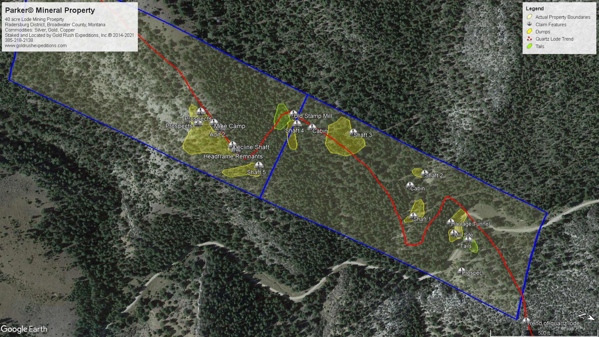
The property contains two mill sites. The first is a double battery stamp mill on the southern claim. This is far off the main road and rarely seen. The tails from this mill show finely processed quartz with pyrites, likely run through a floatation process to separate the gold. The second mill is right on the main road, there is no equipment, but foundations for crushers and power. The tails here are also pulverized quartz.
There is a road that runs through the property and addresses most all of the shafts and adits. near the old camp. This road has been blocked and obscured by felled trees and not used in many years. It would benefit from a dozer push.
The claims trend generally north-south, following geological mapping of gold and silver deposits which run in a massive quartz lode that is well defined on the surface and underground.
The property encompasses the apex of the lode and the relevant workings of the historic Parker group, also known as the Ned, the Globe and the Silver Bell Mine. The property was worked as early as 1860 according to historical records. Currently, there is a gated culvert that provides access into the workings at the lowest level. This level is thought to be for haulage and then development and exploration. There are a few stopes in the workings but there are ore chutes from upper levels indicating that the major development stoping is on upper levels. The haulage level is estimated to have been cut in the early 1900s to work under the shafts and intercept the veins and lodes at depth where they contained higher values of gold and silver.
The upper levels have not been surveyed as their portals were backfilled in the early 1990s as part of an abandoned mine reclamation program. Some of this backfill actually runs down to the haulage level. These shafts and declines will need to be cleared to make the mine generally operational.
There are no less than three shafts that intercept the haulage level. There are also two collapsed adits above the haulage level which indicate there is another level of the workings that is, at current, inaccessible. Surveyors documented over two thousand two hundred feet of linear drifting work on the lowest level. These workings are detailed and mapped and show veins of gold, galena and some small quartz stringers. Also reported was considerable stoping in various areas thought to intercept shafts and declines found on the surface. There are no other open or access points aside from the main portal.
The ores at the Parker are made up of gold, auriferous pyrite, galena, sphalerite and arsenopyrite.
The property stretches along a low hill and ridge. This ridge has been worked and explored by short prospects and some shafts which all follow the same general trend. On the eastern edge of the property there are the remains of a stamp mill and tailings. On the farthest western workings of the property, there is evidence of a larger operation. A cabin and possible mill foundations are visible along with one larger shaft and the remains of an old headframe. These workings far predate the drift level lower on the hill. It is likely that from 1910 to 1950, ore extracted from the mines was transported via the main, lower drift and hand sorted at that level.
The portal in the main canyon is the only access to the underground workings of the mine. The Parker Mining Company drove this drift between 1900 and 1910 and sought to access the ore bodies under the existing shafts and declines. Ore values had shown consistently to increase with depth. This obviously proved to be true and most of the defined orebodies on the claims can be located underground and matched to their shafts.
The Parker Mine is set in the western edge of the Radersburg District on the southern end of the Elkhorn Mountain Range. The district is known for production of native gold and silver with very little quartz. The Parker is a fine example of this model with native gold in auriferous pyrites in small veins from 2 to 18 inches in width exposed in the underground workings. Silver in the form of galena crystals is also present but has been largely discarded and dumped in waste piles around the claims.
The property could be worked by a small miner by high grading the veins and processing close to the mine or at the Paradine Mill at the base of the canyon. The property could easily be developed commercially. It is capable of producing 50 tons a day which could also be trucked down to the Paradine mill and processed.
Gold Rush Expeditions, Inc. does offer mining consultation services and assistance with permits for a small fee.
Training courses for underground work and exploration can be found here: https://stayoutstayalive.com/training/
The Parker site is a 40 acre lode mining property located in the Radersburg Mining district, Broadwater County, Montana. The mine hides its true size from roadside drive-bys. A gated culverted portal and mill foundations are all that is visible. However, there is over 2,200' of subsurface development.
The property contains two mill sites. The first is a double battery stamp mill on the southern claim. This is far off the main road and rarely seen. The tails from this mill show finely processed quartz with pyrites, likely run through a floatation process to separate the gold. The second mill is right on the main road, there is no equipment, but foundations for crushers and power. The tails here are also pulverized quartz.
There is a road that runs through the property and addresses most all of the shafts and adits. near the old camp. This road has been blocked and obscured by felled trees and not used in many years. It would benefit from a dozer push.
The claims trend generally north-south, following geological mapping of gold and silver deposits which run in a massive quartz lode that is well defined on the surface and underground.
The property encompasses the apex of the lode and the relevant workings of the historic Parker group, also known as the Ned, the Globe and the Silver Bell Mine. The property was worked as early as 1860 according to historical records. Currently, there is a gated culvert that provides access into the workings at the lowest level. This level is thought to be for haulage and then development and exploration. There are a few stopes in the workings but there are ore chutes from upper levels indicating that the major development stoping is on upper levels. The haulage level is estimated to have been cut in the early 1900s to work under the shafts and intercept the veins and lodes at depth where they contained higher values of gold and silver.
The upper levels have not been surveyed as their portals were backfilled in the early 1990s as part of an abandoned mine reclamation program. Some of this backfill actually runs down to the haulage level. These shafts and declines will need to be cleared to make the mine generally operational.
There are no less than three shafts that intercept the haulage level. There are also two collapsed adits above the haulage level which indicate there is another level of the workings that is, at current, inaccessible. Surveyors documented over two thousand two hundred feet of linear drifting work on the lowest level. These workings are detailed and mapped and show veins of gold, galena and some small quartz stringers. Also reported was considerable stoping in various areas thought to intercept shafts and declines found on the surface. There are no other open or access points aside from the main portal.
The ores at the Parker are made up of gold, auriferous pyrite, galena, sphalerite and arsenopyrite.
The property stretches along a low hill and ridge. This ridge has been worked and explored by short prospects and some shafts which all follow the same general trend. On the eastern edge of the property there are the remains of a stamp mill and tailings. On the farthest western workings of the property, there is evidence of a larger operation. A cabin and possible mill foundations are visible along with one larger shaft and the remains of an old headframe. These workings far predate the drift level lower on the hill. It is likely that from 1910 to 1950, ore extracted from the mines was transported via the main, lower drift and hand sorted at that level.
The portal in the main canyon is the only access to the underground workings of the mine. The Parker Mining Company drove this drift between 1900 and 1910 and sought to access the ore bodies under the existing shafts and declines. Ore values had shown consistently to increase with depth. This obviously proved to be true and most of the defined orebodies on the claims can be located underground and matched to their shafts.
The Parker Mine is set in the western edge of the Radersburg District on the southern end of the Elkhorn Mountain Range. The district is known for production of native gold and silver with very little quartz. The Parker is a fine example of this model with native gold in auriferous pyrites in small veins from 2 to 18 inches in width exposed in the underground workings. Silver in the form of galena crystals is also present but has been largely discarded and dumped in waste piles around the claims.
The property could be worked by a small miner by high grading the veins and processing close to the mine or at the Paradine Mill at the base of the canyon. The property could easily be developed commercially. It is capable of producing 50 tons a day which could also be trucked down to the Paradine mill and processed.
Gold Rush Expeditions, Inc. does offer mining consultation services and assistance with permits for a small fee.
Training courses for underground work and exploration can be found here: https://stayoutstayalive.com.training/
Acres
Commodities
Type
40
Gold, Silver, Copper
Lode
Underground Dev
Surface Dump
Tailings
2,200 feet
346,990 tons
10,000 tons
Access
Features
Easy 2WD access
Mill Foundations
Gold Reserves
Silver Reserves
Copper Reserves
Platinum Reserves
Tungsten Reserves
Molybdenum Reserves
216,319 oz
1,785,531 oz
Undefined
N/A
N/A
N/A


(385) 218-2138
or use our contact form below