
Click to read more...
Property Overview
The Bar X Mine dates to 1885 and was known as the Esther Silver and Lead.
The mine was taken over in 1941 by Bar X Mining Company who shipped 22 tons of CU, AU and AG (Copper, Gold, Silver).
There are a number of portals on 100 acres of property. The largest portal is roughly 2600' and intercepts several bodies of auriferous pyrite. Assays from the vein returned an average of 1.6 oz AU/ton. High assay was 3.7 oz AU/Ton, low assay was 0.03 oz AU/Ton.
Substantial dumps measured at a total of 33,739 tons. There no tails on the property and all processing appears to have been taken off site.
Dumps were sampled in 24 locations and assay averaged 0.6 oz/AU Ton and 3.1 oz AG/Ton.
The property last reported shipping ore in 1952 according to USGS reports.
Local reports state the property was active in 1979-1982 with several tons of gold ore exported.
There are at least 4100' of documented, mapped sub-surface workings. Quartz is prevalent in the Good Hope portal on the north end of the property.
Excellent access via high clearance vehicles to the main camp. Access to portals may require High Clearance 4WD with low range.
Documented Gold and Silver reserves in surface dumps. No account for ore and deposits underground.
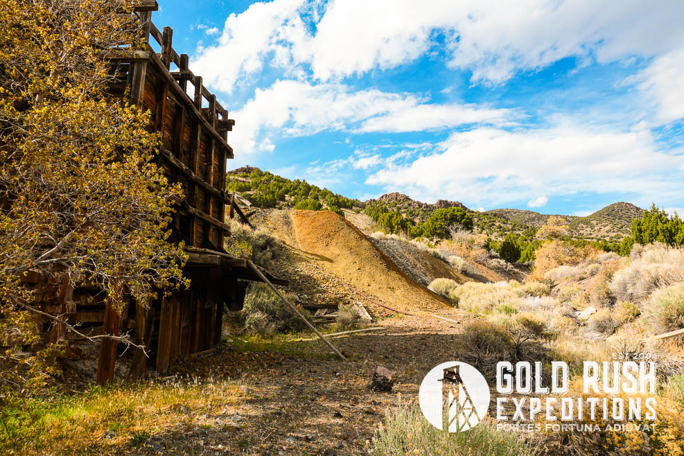
Historic images from 1983 (Credit Tony Krantz). Other photos from 2026 Onsite Survey.
Gold Rush Expeditions, Inc. does offer mining consultation services and assistance with permits for a small fee.
Training courses for underground work and exploration can be found here: https://stayoutstayalive.com/training/
The Bar X Mine dates to 1885 and was known as the Esther Silver and Lead.
The mine was taken over in 1941 by Bar X Mining Company who shipped 22 tons of CU, AU and AG (Copper, Gold, Silver).
There are a number of portals on 100 acres of property. The largest portal is roughly 2600' and intercepts several bodies of auriferous pyrite. Assays from the vein returned an average of 1.6 oz AU/ton. High assay was 3.7 oz AU/Ton, low assay was 0.03 oz AU/Ton.
Substantial dumps measured at a total of 33,739 tons. There no tails on the property and all processing appears to have been taken off site.
Dumps were sampled in 24 locations and assay averaged 0.6 oz/AU Ton and 3.1 oz AG/Ton.
The property last reported shipping ore in 1952 according to USGS reports.
Local reports state the property was active in 1979-1982 with several tons of gold ore exported.
There are at least 4100' of documented, mapped sub-surface workings. Quartz is prevalent in the Good Hope portal on the north end of the property.
Excellent access via high clearance vehicles to the main camp. Access to portals may require High Clearance 4WD with low range.
Documented Gold and Silver reserves in surface dumps. No account for ore and deposits underground.
Historic images from 1983 (Credit Tony Krantz). Other photos from 2026 Onsite Survey.
Gold Rush Expeditions, Inc. does offer mining consultation services and assistance with permits for a small fee.
Training courses for underground work and exploration can be found here: https://stayoutstayalive.com.training/
Acres
Commodities
Type
100
Gold, Silver, Lead, Zinc
Lode
Underground Dev
Surface Dump
Tailings
4,100 feet
33,739 tons
N/A
Access
Features
High Clearance
Mill Site, Trucking/Shipping load out. Auriferous Pyrites
Gold Reserves
Silver Reserves
Copper Reserves
Platinum Reserves
Tungsten Reserves
Molybdenum Reserves
20,243 oz
104,590 oz
N/A
N/A
N/A
N/A


(385) 218-2138
or use our contact form below